
Govt Flags 37 Flood-Prone Zones in Nairobi as Rains Continue
Share
As heavy rains continue to be experienced in different parts of the country, the risk of flooding has increased in both rural and urban areas, with Nairobi and its surroundings being the most affected areas.
The Ministry of Interior, Kenya, has informed the public that they have conducted a mapping exercise under the Nairobi Rivers Regeneration Program and has identified 37 neighborhoods located along major river corridors and locations that are vulnerable to flooding.
In Nairobi East, the areas that were identified are Kiambu, Dandora, Kariobangi, Kayole, Komarok, Njiru, Ruai, Mwiki, Donholm, Savannah, Tassia, and Fedha. Many of these areas are downstream along sections of the Nairobi River.
In Nairobi West, locations that are prone to floods are Madaraka, Nairobi West, Langata, Kawangware, Kangemi, Lavington, Westlands, Parklands, Kitisuru, Spring Valley, Kileleshwa, and Chiromo. In Chiromo areas located along the upstream and midstream sections of the Nairobi River network.
Also Read: Heavy Rains Delay Final Repairs on Outering Road Water Pipeline
Most Areas are within Nairobi
In the North Corridor of Nairobi, neighborhoods such as Mathare, Korogocho, and Lucky Summer have been identified along the Mathare River, where settlements closely border the riverbanks.
Within Nairobi Central, key locations along the river corridor include the Central Business District, Globe, Gikomba, Eastleigh, and the industrial area where sections of the Nairobi River pass through.
Also Read: IEBC Announces Date for Emurua Dikirr By-Election
In Nairobi South, the Ministry of Interior mapping highlights Kilimani, Kibera, South Sea, and South Bay, Mukuru, Kwa Reuben, and Kwa Njenga, many of which are along the corridor of the Ngong River.
The Ministry of Interior, Kenya, continues to coordinate relief and response efforts for residents living in the area who have been affected by flooding.
Follow our WhatsApp Channel for Instant News Updates
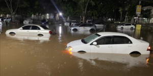
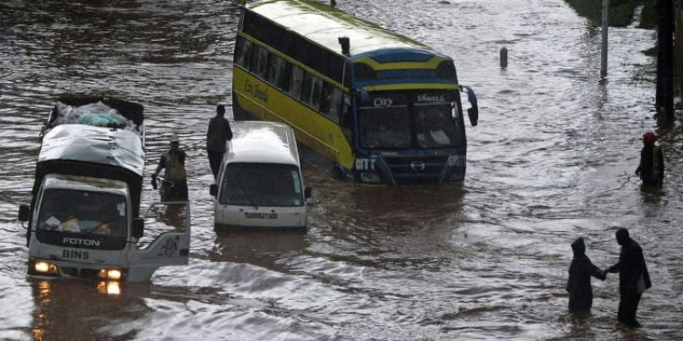
A section of Nairobi affected by flooding. PHOTO/Poa English