
India Backs UN World Map Resolution, Draws Red Line Over Kashmir
Share

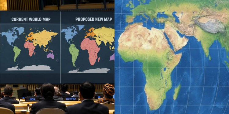
India has backed a United Nations General Assembly resolution promoting equal-area world maps while insisting that any depiction of its territory must follow its official map.
The UN General Assembly adopted the resolution, titled “Correct the Map: Rebalancing Global Cartographic Representation and Promoting Equitable Representation of the World’s Regions, Particularly Africa,” on September 4, 2026.
The measure passed with 164 votes in favor, one against, and six abstentions.
Responding to media queries, Indian Ministry of External Affairs spokesperson Randhir Jaiswal said the resolution is set to seek and promote map projections that preserve the relative sizes of continental landmasses.
“The resolution neither adopts nor authenticates any particular world map,” Jaiswal said, adding that it also does not address political cartography, including international boundaries, disputed territories or place names.
Jaiswal added that India had also explained its vote, stressing the principle of equal-area cartographic representation.
“We also highlighted that the resolution does not constitute endorsement of any specific map, projection or depiction of national boundaries,” he said.
India, however, drew a firm line over how its territory should appear on any map.
“India’s sovereign territory, including the Union Territories of Jammu and Kashmir and Ladakh, must be depicted in accordance with India’s official map,” Jaiswal said.
Also Read: Profile of Daniel Ng’ang’a: The Engineer Who Rose From Poverty to Lead MUWASCO
India’s Non-negotiable Territorial Integrity
He added that any inaccurate or misleading depiction is unacceptable, describing India’s position on sovereignty and territorial integrity as clear, consistent and non-negotiable.
The resolution seeks to address distortions associated with commonly used world maps, particularly the Mercator projection, which can make regions closer to the equator appear smaller relative to their actual land area.
Also Read: JKIA Gold Smuggling: Two Women Nabbed With 658g of Suspected Gold Bound for Dubai.
India’s Territorial Stance
United Nations has also confirmed that the measure was considered at the General Assembly’s 114th plenary meeting on September 4.
India’s position therefore separates its support for more proportionate cartographic representation from its stance on territorial boundaries, which New Delhi says will remain unchanged.
Follow our WhatsApp channel for instant news updates.
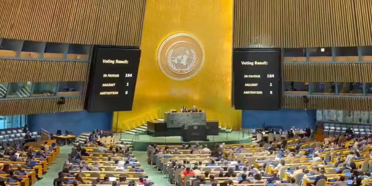
The measure passed with 164 votes in favor, one against, and six abstentions. Photo/UN