
The Politics of Height: How Nairobi’s Plot Ratios Shape Housing, Traffic and Inequality
Share

By Owen Konzolo
Most Nairobians deal with the city’s most powerful housing rule every single day without ever hearing its name. You see it in Kileleshwa when a quiet, leafy bungalow gets knocked down overnight and replaced by a towering 18-storey apartment block even though the sewer pipes underneath were laid back in the 1960s before Kenya even gained independence.
You feel it every morning on the Namanga Highway, stuck in a soul-crushing two-hour jam from Kitengela because living anywhere close to your workplace in town is either outrageously expensive or completely out of reach.
And you see it when whole estates feel completely packed, even though Kenya is still short of over two million decent city homes.
Planners call it the Floor Area Ratio (FAR), but in Kenya’s county offices, it goes by Plot Ratio.
So, what actually is plot ratio? It’s just a simple math formula: you divide the total floor space of a building by the size of the land it sits on. If you own an acre of land and the county gives you a plot ratio of 1.5, you can only build up to 65,000 square feet of floor space.
You can spread that space out flat like a wide pancake or stack it sky-high like a tower; either way, you can’t go past that number. It sounds like boring council paperwork, but this one number is the hidden engine driving Nairobi’s high-rise boom, making landowners rich, and deciding who gets to live where.
Two Cities, One Skyline
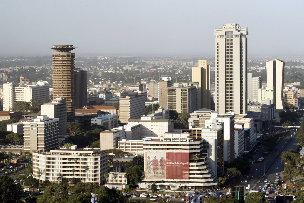
While big global cities use high plot ratios to build massive towers around train stations and business hubs, Nairobi does the exact opposite.
In leafy, posh estates like Muthaiga and Karen where an acre of land costs an eye-watering Ksh 100M to 300M+, county rules strictly keep plot ratios low.
That means you can only build single-family mansions or gated low-rise estates.
Also Read: OPINION: Why Everyone Should Travel Alone at Least Once
Meanwhile, just a short drive away in Kilimani, Kileleshwa, and Upper Hill, City Hall has quietly opened the floodgates.
They’ve pushed plot ratios way up, greenlighting massive 15- to 18-storey apartment towers to pack in the growing middle class. The result? Elite suburbs stay ultra-spacious and green, while neighboring middle-class estates get squeezed tight.
The result is a hyper-segregated landscape where land value and allowable height exist in tension.
| Neighborhood / Zone | Land Value (per Acre) | Plot Ratio Limits | Spatial & Economic Outcome |
| Upper Hill & CBD | ~$4 million | High (3.5–6.0+) | Commercial towers; dense vertical commercial core. |
| Kilimani & Kileleshwa | ~$3.5 million | High (Rezoned up to 3.0+) | Rapid apartment boom; severe pressure on legacy water and sewer grids. |
| Karen & Muthaiga | ~$1 million – $2.5 million | Very Low (0.15 – 0.4) | Strictly preserved low-density residential belts; low land utilization. |
| Peri-Urban Belt (Ruaka, Syokimau) | ~$300,000 – $800,000 | Variable / Weakly Enforced | Rapid horizontal sprawl; long, costly commutes into the city center. |
The High Cost of Pushing Density Outward
When county rules stop us from building enough affordable apartments near where people work, the problem ends up on our roads. Because housing near the city center is either too expensive or restricted, lower- and middle-income workers are forced to move far out to places like Rongai, Ruiru, or Syokimau.
Everyday commuters end up spending up to four hours stuck in matatus or traffic. All this gridlock isn’t just exhausting. It costs Kenya about Ksh 120 billion every year in wasted fuel, lost productive time, and pollution.
![Traffic snarl-up along Waiyaki Way, Nairobi, taken on Thursday, May 2, 2024, at 5:00 p.m. [Photo/Courtesy]](http://hivileo.co.ke/wp-content/uploads/2026/07/Traffic-snarl-up-along-Waiyaki-Way-Nairobi-taken-on-Thursday-May-2-2024-at-500-p.m.-.png)
Traffic snarl-up along Waiyaki Way, Nairobi, taken on Thursday, May 2, 2024, at 5:00 p.m. PHOTO/Courtesy.
In Kilimani, for example, many expensive new apartments now routinely run out of tap water and suffer power blackouts.
To survive, tenants have to rely on costly private water bowsers and noisy diesel generators because the city’s old water and electricity systems can’t handle so many families living on one small plot.
Also Read: Are We Really Living the Soft Life, or Just Performing It Online?
In the absence of affordable, dense formal housing near job clusters, millions of the city’s poorest residents are compressed into informal settlements like Kibera and Mathare, where population density reaches staggering levels, but without basic municipal services.
As Kenya’s urban population is projected to double over the coming decades, city planners and policy experts argue that Nairobi must overhaul how it deploys its zoning levers under the national Physical and Land Use Planning Act.
Urban experts point to three critical reforms:
- Transit-Oriented Densification: Raising allowable plot ratios strictly along primary public transit corridors, such as the Nairobi Commuter Rail network and proposed Bus Rapid Transit (BRT) routes to concentrate population where mass transit already exists.
- Infrastructure Capital Levies: Requiring real estate developers who seek “bonus” plot ratios to pay direct development impact fees, earmarked exclusively for upgrading local water, drainage, and transformer capacity.
- Inclusionary Zoning: Granting developers additional vertical height in exchange for setting aside a percentage of units for affordable, low-income housing near the city core.
Ultimately, the plot ratio is far more than a technical blueprint. It is a social contract. Whether Nairobi evolves into an efficient, connected metropolis or continues to fracture into traffic-strangled sprawl depends entirely on how thoughtfully that single number is assigned.
Follow our WhatsApp channel for instant news updates.
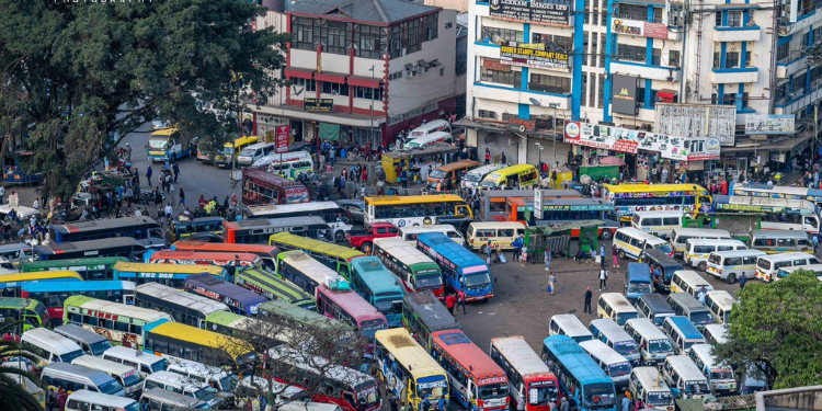
Public Service Vehicles in Nairobi CBD. PHOTO/ Courtesy.